What You'll Find in This Article
What Even Is the Olleh Trail?
Let’s start with the name. The word 올레 (olle) comes from the Jeju dialect. In traditional Jeju architecture, “olle” referred to the narrow alleyways connecting homes to the main road. It also sounds like “would you come?” in Korean. The trail builders had a sense of poetry about them.
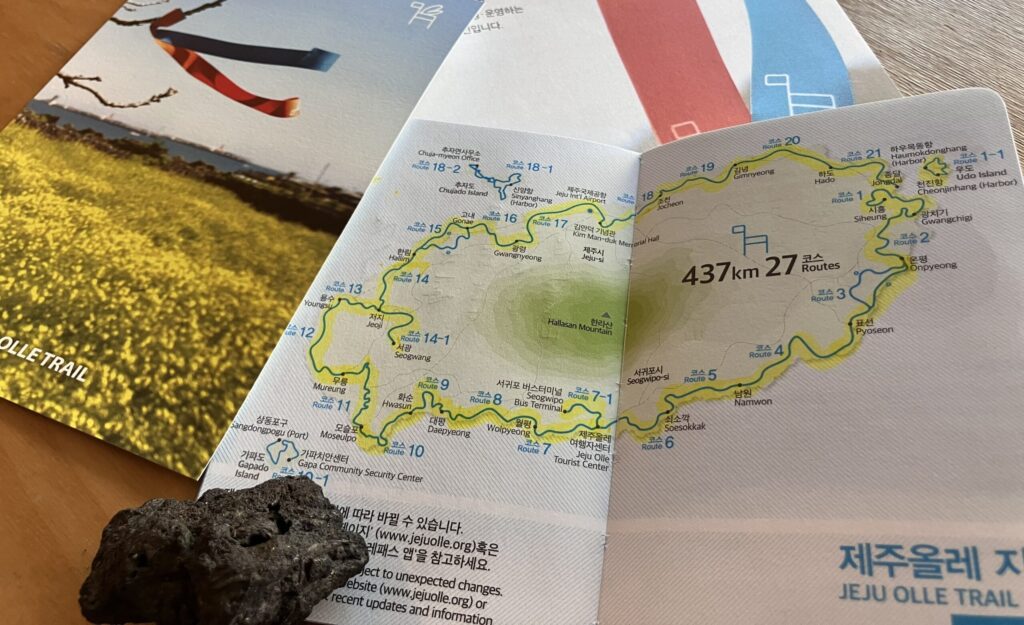
The Jeju Olleh Trail (제주 올레길, Jeju Olle-gil) is a 437-kilometer network of 27 walking routes that circles the main island of Jeju and extends to three offshore islands: Udo (우도), Gapado (가파도), and Chujado (추자도). It opened in September 2007, when a small group of hikers in sturdy boots descended on a tiny elementary school in Siheung-ri, walked into an open field, and set off without a designated trail or marked path. That was Route 1. They figured it out as they went.
These days, the trail is anything but improvised. It’s one of Asia’s best-maintained long-distance walking routes, with clear signage, stamp stations, and a passport system that turns the whole thing into a very satisfying collector’s quest.
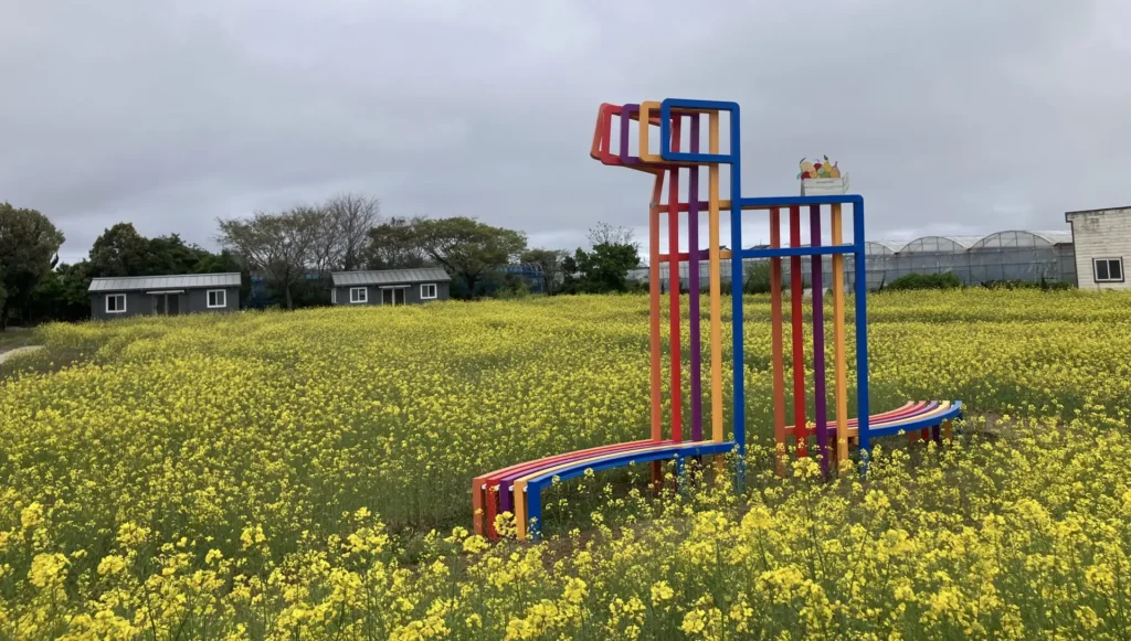
This is not a wilderness trek. The trail passes through fishing villages, tangerine farms, oreums (volcanic cones), lava rock coastlines, Jeju’s only rice fields, urban neighborhoods in Jeju City and Seogwipo City, black sand beaches, ancient Gotjawal forests, wind generator parks, and the occasional fancy café sitting shoulder-to-shoulder with a tiny village convenience store. That’s the whole point. You’re walking through everyday Jeju life at a pace that lets you actually see it.
The Symbol of the Trail: The Ganse
You’ll see this small pony figure everywhere on the trail. The 간세 (ganse) is the Olleh Trail’s mascot and, more practically, its primary navigation marker. The word ganse is the local Jeju word for pony, derived from “ganse-dari,” meaning “slow idler” in the Jeju language.
The Jeju pony has a deep history on this island. Jeju was occupied by the Mongols for roughly a century during the Goryeo Dynasty, and it was during this period that horses became central to Jeju’s identity. The Mongols used Jeju as a breeding ground for their military horses, and the small, hardy Jeju pony is a direct descendant of those Mongolian horses. When the trail was designed, using the ganse as its symbol was a way of reaching back into that history.
The ganse signposts are placed at the starting and finishing points of each route. At forked roads, the ganse points its nose in the direction you should walk. At tourist attractions, the saddle on the ganse includes site descriptions. The ganse also ends up on tote bags, keychains, dolls, magnets, and in the gift shop across from Trail HQ in Seogwipo.
The Routes: 27 of Them, None Boring
The 27 routes cover a combined 437 kilometers. Average route is roughly 10-19 kilometers and takes 4-6 hours to complete. All routes require no technical skill. You need working legs, reasonable footwear, and a willingness to keep going when it gets uncomfortable.
Some routes offer a choice between two paths: one that follows the coastline, the other cutting inland to an oreum or through Gotjawal forest. When you see an A/B fork, that’s what you’re choosing between. Either path brings you to the same endpoint.
Route details below, including distances, difficulty ratings, and highlights, are drawn from the official Jeju Olle Trail guidebook. Conditions, access, and ratings can change, so confirm current status at jejuolle.org before you head out.
The 21 Main Routes
Route 1 — Siheung to Gwangchigi (15.1km, Medium) The trail’s opening act. From Siheung-ri’s carrot and radish fields, you climb Malmi Oreum (126m) and Al Oreum (146m) for panoramic views of Seongsan Ilchulbong, Udo Island, and the eastern sea. The trail descends into Jongdal-ri village and ends at Gwangchigi Beach, famous for its mix of black and white sand and sunrise views that justify the name.
Route 2 — Gwangchigi to Onpyeong (15.6km, Medium / Split A-B) Starts at the water and climbs halfway through to Daesusanbong Peak, with the oreum trail running dark through trees — the guidebook recommends walking this one with company. The route passes Gosung 5-day Market before ending at Onpyeong Port.
Route 3 — Onpyeong to Pyoseon (A: 20.9km, High / B: 14.6km, Easy) Route 3 splits early. Route A goes inland through tangerine groves and up to Tong Oreum (143m), whose summit turns lavender purple in autumn. Route B hugs the Badang Olle coastal path, where you might spot dolphins from Sinsan-ri Village Café, which doubles as the midpoint stamp station. Both paths rejoin at a coastal livestock farm offering one of the most unusual views on the entire trail.
Route 4 — Pyoseon to Namwon (19km, Medium) The longest main route. The first half follows the coast past haenyeo diving grounds along the restored Gama-ri Haenyeo Olle, a path the diving women used for generations to reach the sea. The second half turns inland through tangerine farms and volcanic terrain. The guidebook notes that both physical and mental endurance are needed, given the long asphalt stretch early on.
Route 5 — Namwon to Soesokkak (13.4km, Medium) Notable for the Keun-ung Hill Scenic Walkway, a flat coastal road hemmed in by lava cliffs up to 20 meters high. The route passes a camellia forest (spectacular in winter when the red flowers bloom), a freshwater pool cut into volcanic rock, and ends at Soesokkak, the famous estuary where a freshwater stream meets the sea.
Route 6 — Soesokkak to Jeju Olle Tourist Center (11km, Easy) The Seogwipo urban route. Starts with an oreum climb (Jejigi Oreum, 94.8m) and a dense forest walk, then moves through Seogwipo’s coastline past Sojeongbang Waterfall and Jeongbang Waterfall. The finish is at the Jeju Olle Tourist Center in downtown Seogwipo, where you can collect your certificate and medal if you’ve finished all 27 routes, or just have a craft beer at the pub on the ground floor.
Route 7 — Jeju Olle Tourist Center to Wolpyeong (17.6km, Medium) One of the trail’s most beloved routes. Rocky coastal paths with sustained ocean views. The guidebook calls the seaside rocky sections “a little tough” but says “there is no doubt that Route 7 is one of the most beloved hikes.” The midpoint stamp is at Olleyo 7 Rest Area.
Route 8 — Wolpyeong to Daepyeong (19.6km, Medium) Passes through the Jungmun resort area with its long stretch of Jungmun Saekdal Beach. The Berinnae Oreum Observatory section offers elevated views. The latter stretch to Daepyeong Port is flat and accessible enough for strollers and wheelchairs on the designated section.
Route 9 — Daepyeong to Hwasun (11.8km, High) The shortest of the main routes but rated High difficulty, with rugged volcanic rock coastal paths. Ends at Hwasun Golden Sand Beach, one of the few beaches on Jeju with genuine golden sand rather than the white or black varieties found elsewhere.
Route 10 — Hwasun to Moseulpo (15.6km, Medium) A long westward sweep through Songaksan Mountain area, past lava columnar joints and toward the southern tip of the island. Passes Hyeongjeseom Island viewpoints. Ends in Moseulpo, the port town where ferries depart for Gapado Island.
Route 11 — Moseulpo to Mureung (17.3km, Medium) One of the more remote and quiet stretches of the trail. Runs through Gotjawal forest, past pristine coastal sections, and through the Hamo Sports Park area. Fewer services along this route — carry water and food.
Route 12 — Mureung to Yongsu (17.5km, Medium) Northwest coast route past the dramatic sunset views at Chagwido Island. The Eongang-gil section near Suweolbong Peak is a highlight, with the ocean dropping away sharply on one side. Ends at Yongsu Reservoir and Port.
Route 13 — Yongsu to Jeoji (16.2km, Medium) Passes through Nakcheon-ri, known locally as “Chair Village” for the unusual rock formations. The route offers views of smaller outlying islands and runs through traditional farming villages before ending near Jeoji village.
Route 14 — Jeoji to Hallim (19.1km, Medium) Considered one of the trail’s most beloved by regular hikers. The first half runs through mountainous Jungsangan Olle with pine forest paths, passing Kim Young-gap Gallery (a former tangerine warehouse turned cultural complex with cafés and a gallery). The second half opens onto the west coast with views of Biyangdo Island and its emerald waters, finishing at Hallim Harbor. While you’re walking this stretch, keep an eye out for wild dolphins.
Route 15 — Hallim to Gonae (15.8km, Medium / Split A-B) Route A goes inland through Jungsangan forest toward Seonwunjeongsa Temple (which hosts an 11th-century Buddhist statue). Route B sticks to the coast, passing the Jeju Hansupul Haenyeo School where new haenyeo are trained, and Gwakji Beach. Both paths offer views of Biyangdo Island, the youngest volcanic island in Jeju, formed roughly 1,000 years ago.
Route 16 — Gonae to Gwangnyeong (18.1km, Medium) The Aewol coastal route. Dolphins show up in the coastal waters of Aewol periodically. The route passes a traditional stone lighthouse where fishermen once burned fish oil to signal safe returns, and through the Hangpaduri Hangmong Historical Site, a Goryeo-era fortress.
Route 17 — Gwangnyeong to Old Downtown Jeju City (19.8km, Medium) The route that brings you into Jeju City, threading through cherry blossom-lined riverside paths in spring before reaching the airport coastline and downtown. Passes Aljakji Pebble Coast, designated a Natural Monument, and Dodubong Peak along the way.
Route 18 — Old Downtown Jeju City to Jocheon (11.4km, High) Rated High difficulty. Starts from Ganse Lounge in downtown Jeju City and climbs Sarabong Peak (148m) and Byeoldobong Peak (136m). Sarabong’s sunset was selected as one of Jeju’s top 10 spectacles. The route passes the Goneul-dong Village Site, burned down during the April 3 Resistance Movement of 1948, and Samyang Black Sand Beach, famous for therapeutic sand bathing.
Route 19 — Jocheon to Gimnyeong (17.6km, Medium) Begins at Jocheon Manse Dongsan, a historical site of anti-Japanese resistance movements. Passes Hamdeok Seoubong Beach (emerald waters, rocky and sandy mix), Gotjawal forest sections, and villages that carry the history of Jeju’s April 3 Resistance.
Route 20 — Gimnyeong to Hado (11.3km, Easy) Northeast coast route with wind generators visible from the lava rock coastal path. Passes Woljeongri Beach and the Sehwa 5-Day Market, the largest in eastern Jeju. Ends at the Jeju Haenyeo Museum, the appropriate endpoint for a route that runs through haenyeo country.
Route 21 — Hado to Jongdal (connects back to Route 1) The loop-closer. Passes the Haenyeo Museum starting point, through Byeolbangjin Fortress (a Joseon-era coastal defense wall), and climbs Jimibong Peak (“Land’s End” in the Jeju language) for a final panoramic view before descending to Jongdal-ri Beach. Route 21 is where the circle completes.
The Sub-Routes and Alternate Trails
Route 7-1 — Seogwipo Bus Terminal to Jeju Olle Tourist Center (15.7km, Medium) The inland alternative to Route 7. Climbs Gogeunsan Mountain (the ascent is steep despite wooden stairs), then passes through Hanon Crater, Asia’s largest maar — a volcanic crater that once held water for growing rice. The summit views sweep across Seogwipo City and the southern sea. Ends at the same Jeju Olle Tourist Center as Route 7.
Route 14-1 — Jeoji to Seogwang via Gotjawal (9.3km, Easy) An inland alternative running through the dense Gotjawal forest, one of Jeju’s most unique ecosystems. Passes Mundoji Oreum and ends at the O’Sulloc Green Tea Fields. Important note: no restaurants or convenience stores on the entire route except at the start and the O’Sulloc finish point. Bring everything you need.
The Island Routes (Ferry Required)
Route 1-1 — Udo Island (13.3km, Medium) Accessible by ferry from Seongsan Port (approximately 15 minutes). A circular route around Udo passing white coral sand beach, black lava sand beach, haenyeo diving grounds, Udo Lighthouse Park (Korea’s first lighthouse park), and Udobong Peak (132.5m) — from the summit you can see a rock formation shaped like the Korean Peninsula at low tide. Watch out for scooters. They share the road with hikers and there are a lot of them.
Route 10-1 — Gapado Island (가파도, 4.2km, Easy) Korea’s southernmost inhabited island. Accessible by ferry from Woonjinhang Harbor near Moseulpo (ferry info: 064-794-5490). A flat 4.2-kilometer loop through barley fields and fishing village with views back to the Jeju mainland. Good for beginners or anyone who wants a genuine Olle stamp without committing to a full day of walking.
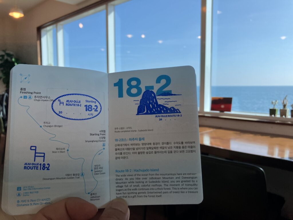
Routes 18-1 and 18-2 — Chujado (추자도) These two routes are in a category of their own. Chujado is not a short ferry hop — it’s a 2.5 to 3.5-hour journey one way from Jeju Port, and the official guidebook states it is “nearly impossible to complete the route in a single day.” Plan to stay overnight. Plan for two full days on the island if you want to walk both routes properly.
Chujado is an archipelago of four inhabited and 38 uninhabited islands. Crucially, it is not volcanic basalt like the rest of Jeju — it’s rhyolite, which means the geology, scenery, and even the culture feel noticeably different from anything else on the Olle Trail. The views from the peaks look out over scattered islands to the north and, on clear days, Hallasan in the distance to the south.
Also worth knowing: the ferry can be canceled due to bad weather. Check with the ferry companies before you commit to dates.
Route 18-1 — Sangchujado Island (11.4km, Medium): Begins at Chujahang Harbor, a working fishing harbor with restaurants and stores. Climbs Bonglesan Mountain (85.5m), passes Chuja Lighthouse at the island’s highest point for a full panoramic view of the archipelago, crosses Chujagyo Bridge to Hachujado, and traverses Dondaesan Mountain (164m, the tallest peak in the archipelago) before ending at Sinyanghang Harbor. The dried yellow corvina fishing culture is what Chujado is best known for — anchovies and corvina make up the bulk of the island’s catch. The guidebook specifically notes the sunset from Bonglesan Mountain as a reason to stay over.
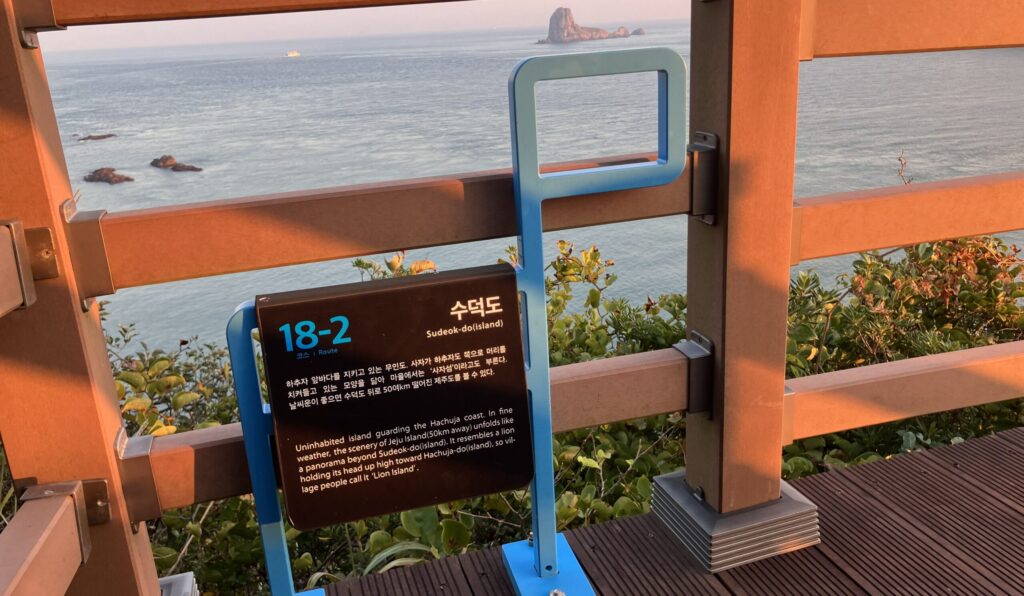
Route 18-2 — Hachujado Island (9.7km, High): Opened in 2022. Rated High difficulty — the uphill and downhill repeats across Seokducheongsan Mountain, Jolboksan Mountain, and Daewangsan Mountain are genuinely challenging on a short route. Starts at Sinyanghang Harbor (where Route 18-1 ends), passes the crescent-shaped Mongdol Coast and the Seokdu Cheongsan Pavilion (one of Chuja’s ten celebrated scenic views), with views of Sudeokdo Island — known locally as Lion Island for its shape — from Jolboksan. Ends back at Sangchujahang Harbor. Food options on Hachujado are limited to two restaurants near the harbor and one Chinese restaurant in Sinyang-ri village that requires a call ahead to confirm it’s open. Bring a packed lunch.
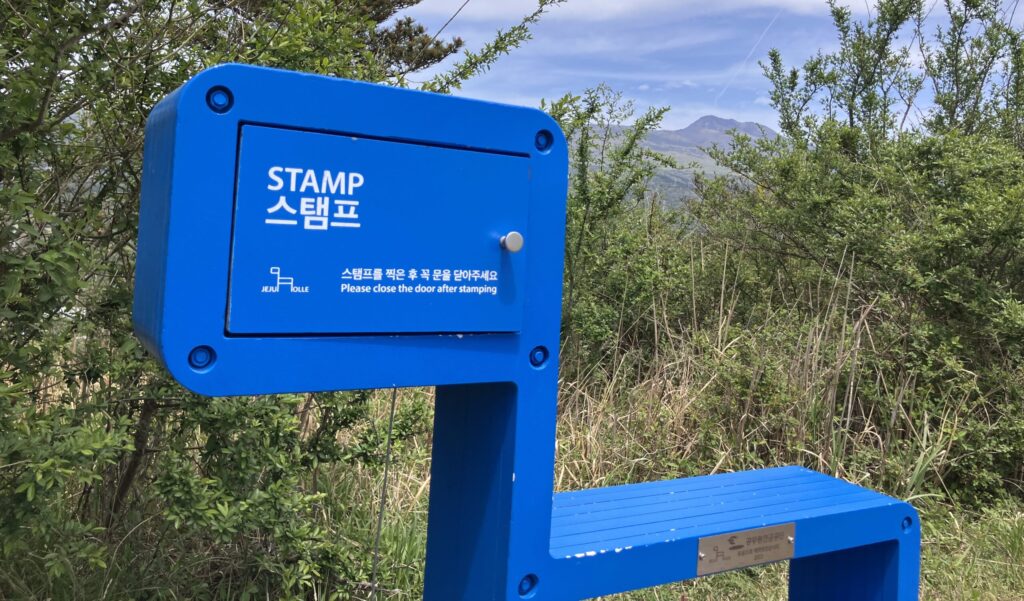
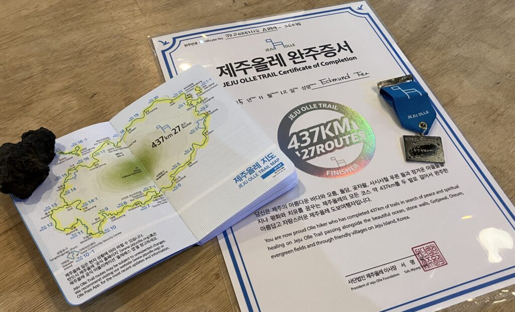
The Passport and Stamp System
This is the part that turns the trail into an obsession.
The Jeju Olle Trail Passport is a small booklet, designed to be passport-sized, with stamping pages for all 27 routes. It costs 20,000 won and is available at the Jeju Olle Tourist Center in Seogwipo and at the Ganse Lounge in Jeju City (7-5 Gwandeok-ro 8-gil, open 10am–6pm, closed Korean national holidays).
At each route, there are three stamp stations: start, midpoint, and finish. Each stamp is unique, designed around a symbol for that route — Route 1 has Siheung Elementary School, Route 20 has a windmill, Route 21 has Byeolbangjin Fortress. They are small works of art and collecting them is genuinely satisfying.
Complete all 27 routes and you can claim a finisher’s certificate and a thru-hike medal (your choice of blue or orange) at the Jeju Olle Tourist Center (22 Jungjeong-ro, Seogwipo City, phone 064-762-2167) or at the Ganse Lounge in Jeju City.
Pro tip: You can miss up to three midpoint stamps out of 27 and still qualify as a finisher. The trail gives you a little grace.
BTW: The passport also gets you discounts at registered stores along the trail, including on flights and accommodations.
Navigation: How to Not Get Lost
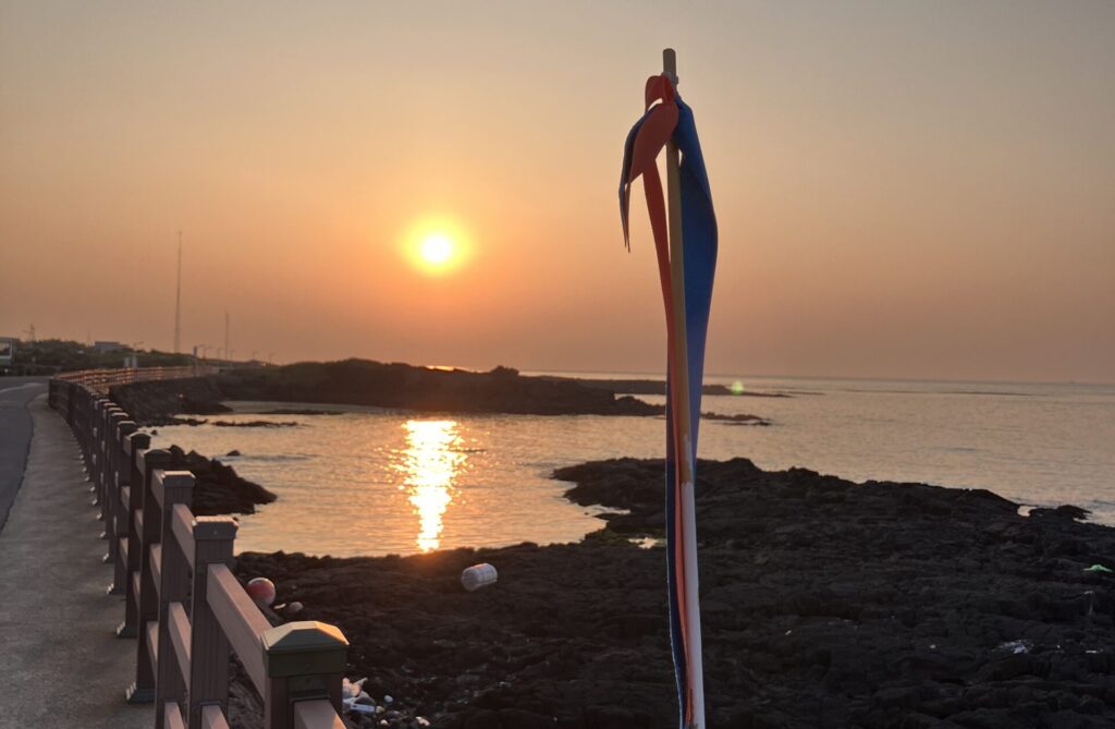
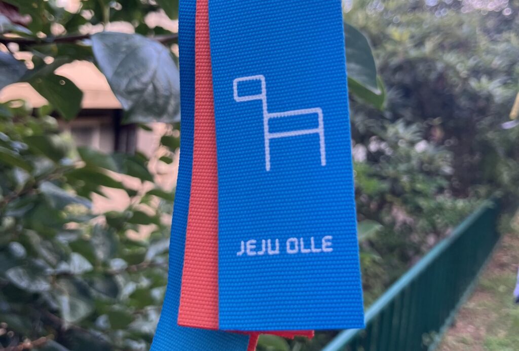
Blue and orange ribbons are tied to trees, walls, utility poles, and fences at slightly above eye level. When you haven’t seen one in five minutes, backtrack. That’s the system.
The ganse signpost markers show direction and route distance. Orange is the standard counter-clockwise direction (Route 1 onward). Blue is the reverse. At tourist attractions, the ganse saddle includes descriptions of the site.
A few practical notes:
- Many signs are in Korean only. This is manageable when you’re on a ribbon-marked path, but gets tricky in urban sections where the trail threads through neighborhoods. Pay extra attention in towns.
- The official website jejuolle.org and the Jeju Olle app have route maps and stamp station locations.
- For buses to and from trailheads, use KakaoMap. For precise bus timetables on rural routes, check the official Jeju bus website (bus.jeju.go.kr) directly — app real-time data is sometimes inaccurate on the green village buses.
Getting to the Trailheads: You Don’t Need a Car
People say you have to rent a car on Jeju. You do not have to rent a car on Jeju.
I completed the entire 437-kilometer Olleh Trail over three weeks using only public buses. Every morning I’d take a bus from my lodging to a trailhead. Every afternoon, after finishing a route, I’d catch a bus from the endpoint back to base. It works. The bus ride back, when you finally get to sit down, is one of the more underrated pleasures of doing the trail this way.
Here’s what you need to know:
Red buses (100s) are express. Fewer stops, faster between major points. Fare: around 2,000–3,000 won with a transportation card.
Blue buses (200s and 300s) are the main-line workhorses. Bus 201 runs the east coast between Jeju City and Seogwipo via Seongsan. Bus 202 covers the west coast. These two routes alone get you to a large number of trailheads.
Green buses (400s, 600s, 700s) serve local villages. Some run every 30 minutes. Others run three times a day. Always check the timetable before committing.
How to pay: Use a T-money card (티머니), rechargeable at any CU, GS25, or 7-Eleven. As of 2025, Jeju buses also accept contactless Visa, Mastercard, and UnionPay — tap your card or phone. Base fare is about 1,150 won with T-money.
Transfer discount: If you tap off one bus and tap on another within 40 minutes, you don’t pay a second fare. If you time it right, you can get from a remote trailhead endpoint across the island on one base fare.
Real talk: Some trailheads require a 15–30 minute walk from the nearest bus stop. Build that into your timing. Check the last bus before you head out — buses stop running around 10–11pm, and a late dinner in a small village can strand you if you’re not paying attention.
Mini Olleh Routes: All the Taste, Without the Full Commitment
Not everyone has three weeks. Not everyone wants to hike 15 kilometers in a day. That’s fine. Even a 60-minute section of the Olleh Trail gives you a legitimate taste of what the trail is about. If you have a passport, you can still collect at least a start or finish stamp.
Here are some accessible sections you can do without a car, organized by area.
North Coast (Jeju City)
Sarabong (사라봉) — Route 18 start Approx. 45–60 minutes
Sarabong Peak (148m) sits at the harbor edge of Jeju City. One of Jeju’s top 10 spectacles for sunset views. Walk up to the top for views across the harbor, downtown, and Hallasan, then come down past harbor murals. Buses serve the area, though the peak is about 10–15 minutes on foot from the nearest stop.
Dodubong (도두봉) — Route 17 midpoint Approx. 60–75 minutes
Follows the Rainbow Coastal Road along Jeju City’s northern shoreline. Cafes line the route.
Northeast Coast
Haengwon to Gimnyeong Beach — Route 20 midpoint Approx. 90–105 minutes
Start at Abebebe Bakery Bikilla and Camel Coffee — two separate businesses connected by a walkway — follow the trail around the lava rock coastal path past wind generators to Woljeongri Beach, then on to the Haengwon Windpower National Generator Demonstration Complex and Gimnyeong Beach. Two beaches, a working wind farm, signature lava rock paths, and cafes at both ends. Bus 201 stops near Gimnyeong Beach on one end and about 10 minutes from Abebebe Bakery on the other.
East Coast
Gwangchigi Beach — Route 1 end / Route 2 start Approx. 45–60 minutes
Walk from the base of Seongsan Ilchulbong along Seongsan Harbor, across the causeway bridge (good view of the lagoon with Ilchulbong behind it), to Gwangchigi Beach. The beach’s mix of black and white sand is distinctive. Willala near the endpoint does tempura-style fish and chips. Bus 201 serves both ends.
Sehwa Beach — Route 21 start Approx. 45–60 minutes
Start at Sehwa Beach and walk toward the Haenyeo Museum, through farms and the inshore route, to the back of Byeolbangjin Fortress (the recently restored Joseon-era defensive wall). Recommended to stop at the fortress and walk the coastal road to the Route 21 midpoint, where there’s a well-regarded guksu (noodle) restaurant. Suggested approach: take the bus out, walk back.
Southeast Coast
Tosan-ri — Route 4 midpoint Approx. 45–60 minutes
Walk from Tosan Port through a forest and lava rock trail past the Sonocamp Jeju Heart Tree to Sehwa Port (in Pyoseon-myeon — not the Sehwa near the Haenyeo Museum). Honest note: food options along this section are limited. Bus 201 serves both ends.
South Coast (Seogwipo City)
Jeju Olleh Trail HQ — east on Route 6 Approx. 60–75 minutes
Start from the Jeju Olle Trail Foundation HQ, stamp your passport, and head east towards the Seogwipo Daily Market, down Lee Jung Seop Street, and on to Jeongbang Waterfall and the smaller Sojeongbang Waterfall. Lee Jung Seop Streep has lots of cafes and souvenir stores and is named for the Korean artist who lived here with his family during the Korean War in 1951. The small replica of the rental family home — reportedly 3.3 square meters for four people — is free to visit. There is bus access from Sojeongbang Waterfall, approximately 10 minutes to downtown.
Jeju Olleh Trail HQ — West on Route 7-1 Approx. 45–60 minutes
Start from the Jeju Olle Trail Foundation HQ, stamp your passport, and head east towards the Hanon Oreum rice fields, pass Bonglimsa Temple, ending near Renault Korea where frequent buses run back to downtown Seogwipo.
Southwest Coast
Hwasun “Golden Sand” Beach — Route 9 section Approx. 75–90 minutes
Walk from Hwaguchi Beach (black sand) past the Hamel Monument to the base of Sangbansan and toward Yongmeori Coast. One of the more scenic southwest sections. Local buses to this area are infrequent — about 5 minutes on foot from the nearest stop at Sakye Port. Plan your return journey before setting out.
Logistics in Brief
When to go: Spring (April–May) and autumn (September–October) give the best conditions. Summer is hot, humid, and rainy. Winter is cold and windy but the trail stays open. The trail officially closes at 6pm in summer and 5pm in winter.
What to wear: Broken-in shoes with grip. The trail mixes rocky coastline, dirt paths, forest floors, and paved roads. Layers matter on the coast because the sea wind doesn’t ask permission. A waterproof layer is worth carrying regardless of the forecast.
Water and food: Most routes pass through villages with convenience stores, cafés, or restaurants. The longer and more remote routes — Route 11, Route 14-1, the Chujado routes — have fewer options. Carry more on those. Route 4 midpoint is notably sparse.
Where to stay: Minbak (민박) family-run guesthouses near the trail are the most authentic accommodation option. The Jeju Olle Tourist Center in Seogwipo has Olle Stay on the third floor — dormitory (25,000 won) and single rooms (38,000 won).
Etiquette: The trail runs through people’s farms and fishing communities. Stay on the marked path. Don’t pick fruit. Close gates you open. A simple annyeonghaseyo (안녕하세요) goes a long way.
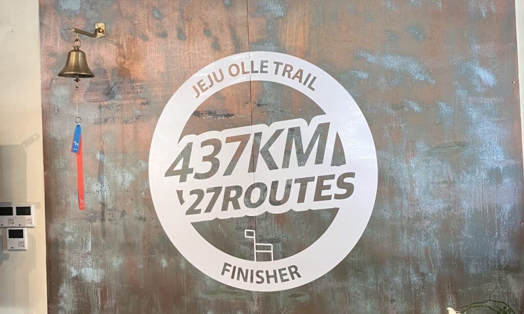
The Thru-Hike: What Finishing All 27 Routes Actually Means
437 kilometers. 27 routes. Multiple visits for most people, or three uninterrupted weeks if you have them.
Not many Jeju residents have finished the full trail. If you do it, the certificate and medal are genuinely earned.
Collect them at the Jeju Olle Tourist Center (22 Jungjeong-ro, Seogwipo City, phone 064-762-2167) or the Ganse Lounge in Jeju City (7-5 Gwandeok-ro 8-gil, open 10am–6pm, closed Korean national holidays). Your choice of blue or orange medal.
One More Thing
The trail is free to walk. The passport costs 20,000 won. Bus fare runs a few thousand won per trip. The views of the East China Sea from a lava cliff cost nothing.
Everything else — the seafood in the trail villages, the cafés at Woljeongri Beach, the craft beer at the Jeju Olle Pub on the ground floor of Trail HQ — is optional. The trail itself asks only that you show up, pay attention, and walk.
That’s a good deal, so use our Jeju Trip Planner to customize your own Olleh Trail adventure.
